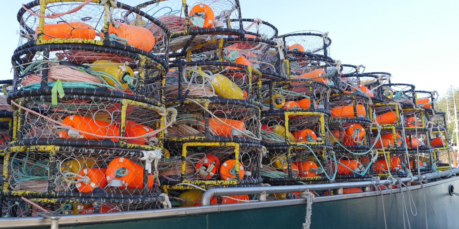
Entanglement in fishing gear is a major threat to whales. It can cause drowning and infections and impair their ability to swim or eat. In 2022, the National Oceanic and Atmospheric Administration (NOAA) confirmed 28 entangled whales off Alaska, Washington, Oregon and California, plus two in Mexico that were caught in U.S. West Coast fishing gear. Dungeness crab gear was responsible for at least nine of these. Historically, little has been known about the overlap between whales and crab gear along the West Coast, making it hard to set policies to reduce entanglements.
That has changed in Oregon waters thanks to a team that included Oregon Sea Grant’s marine mammals Extension specialist, Leigh Torres. The researchers developed models that connected ocean and climate conditions from 2011 to 2020 with sightings of humpback, fin and blue whales off Oregon. They then created maps of predicted whale densities for every month during this period. The team then laid these maps over Dungeness crab fishing locations during that period to determine where and when whales were most at risk of entanglement.
The findings suggest that risk is higher in nearshore waters, particularly in April when seasonal whale densities begin to increase while Dungeness crab fishing continues. Exposure was lower during the marine heatwave from 2014 to 2016 when whales were predicted to be less abundant because of poor ocean and prey conditions. This latter result was surprising because it differed from prior research on entanglement risk in California, highlighting the value of conducting regional assessments.
The research was in response to a need identified by a whale entanglement working group that we convened from 2017 to 2019 as part of Oregon Sea Grant's commitment to engage with fisheries communities to address emerging issues, improve socioeconomic resilience and ensure environmental sustainability. The group, which included fishermen, the Oregon Department of Fish and Wildlife (ODFW) and several environmental nonprofits, developed a best practices directive and cited a need for data about distribution patterns of whales in Oregon waters.
As a result, Torres’ team has taken to the air in Coast Guard helicopters every month since February 2019 to map the location of whales. The researchers also surveyed for whales from NOAA ships. With these two efforts, they surveyed 17,400 miles of Oregon waters from 2019 to 2021, according to Torres. The team shared its findings with ODFW to help it design new regulations, which the agency adopted in September 2020, to reduce entanglements.
In some cases, the source fishery of entanglements is not known, making it hard to design mitigation strategies. At NOAA’s request, Oregon Sea Grant organized and facilitated an online workshop in 2022 to inform a required feasibility study about making groundfish pot gear – like that used in the sablefish industry – more identifiable and modifying it to reduce entanglements of protected humpback whales.
At the meeting, over 50 people, including 12 commercial fishing industry members, rated and prioritized ideas. Suggestions included using more permanent markings on buoys and attaching electronic devices to gear to signal its location. A summary report was sent to NOAA and to over 4,000 parties. In March 2024, the Pacific Fishery Management Council is expected to adopt gear-marking recommendations that include options identified during the workshop.